Organizing Geospatial Data case study on China Eastern Railway

This article is about some random outcomes for organizing info in a Multi Language Maps.

The Original Map Image is in both Russian and Traditional Chinese:

img

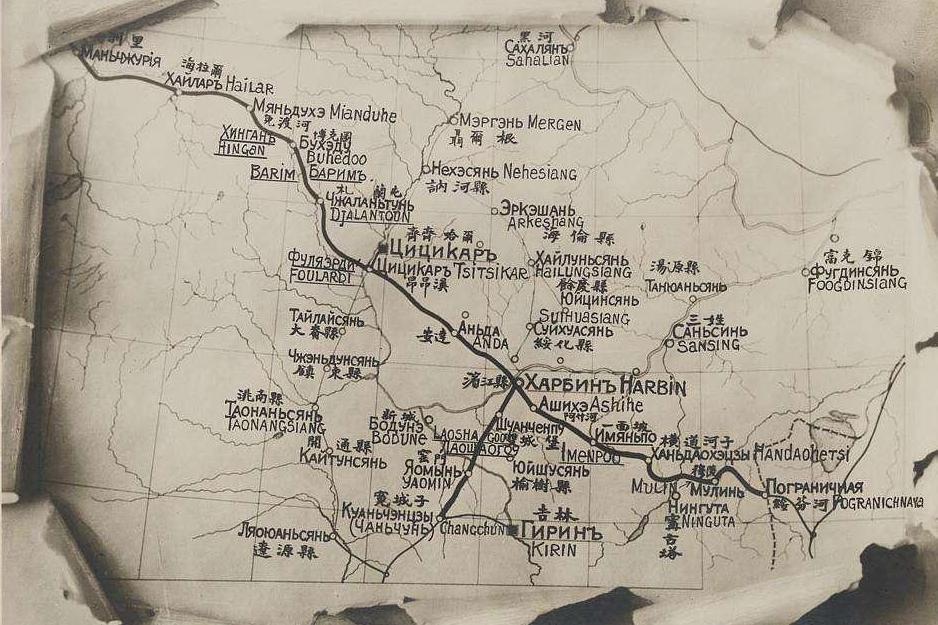
After OCR through free version web tools:

ID English Name Chinese Name Russian Name Longitude Latitude Country Belonged To Year of Train Station Built
1 Changchun 长春 Чанчунь 125.323544 43.817071 China 1898
2 Shenyang 沈阳 Шэньян 123.431472 41.805698 China 189
3 Tianjin 天津 Тяньцзинь 117.199500 39.085097 China 1888

After Cleaning to Json Format:

 1
 2
 3
 4
 5
 6
 7
 8
 9
10
11
12
13
14
15
16
17
18
19
20
21
22
23
24
25
26
27
28
29
30
31
32
33
34
35
36
37
38
39
40
41
42
43
44
45
46
47
48
49
50
51
52
53
54
55
56
57
58
59
60
61
62
63
64
65
66
67
68
69
70
71
72
73
74
75
76
77
78
79
80
[
  {
    "_id": 13,
    "title": "长春",
    "location": {
      "type": "Point",
      "coordinates": [
        125.323544,
        43.817071
      ]
    }
  },
  {
    "_id": 14,
    "title": "沈阳",
    "location": {
      "type": "Point",
      "coordinates": [
        123.431472,
        41.805698
      ]
    }
  },
  {
    "_id": 15,
    "title": "天津",
    "location": {
      "type": "Point",
      "coordinates": [
        117.1995,
        39.085097
      ]
    }
  },
  {
    "_id": 16,
    "title": "北京",
    "location": {
      "type": "Point",
      "coordinates": [
        116.407396,
        39.9042
      ]
    }
  },
  {
    "_id": 17,
    "title": "鞍山",
    "location": {
      "type": "Point",
      "coordinates": [
        122.994646,
        41.108546
      ]
    }
  },
  {
    "_id": 18,
    "title": "大连",
    "location": {
      "type": "Point",
      "coordinates": [
        121.614682,
        38.913689
      ]
    }
  },
  {
    "_id": 19,
    "title": "元山",
    "location": {
      "type": "Point",
      "coordinates": [
        125.754249,
        39.160949
      ]
    }
  }
]